The Starr LaCoote Memorial Bikeway
Portions of Passamaquoddy ancestral land were taken to facilitate highway construction, including US-1 through Indian Township. No compensation was provided. The road is heavily traveled and dangerous.
“We make a road for the spirits. For the spirits to pass over.”
The Bikeway Lane that we are walking along runs parallel to U.S. Route 1, a major coastal highway that takes a westward course following the curve of the St. Croix River before swooping inland at Baileyville and cutting directly through the Passamaquoddy Reservation at Motahkomikuk. Route 1 is a heavy local traffic corridor frequently traveled by logging trucks.
“Rather than protecting the Indians’ trust lands, the state authorized some tracts to be flooded by dams, others to be annexed for the laying out of Route 1 in Indian Township and Route 190 at Pleasant Point, and thousands more acres transferred to white owners.”
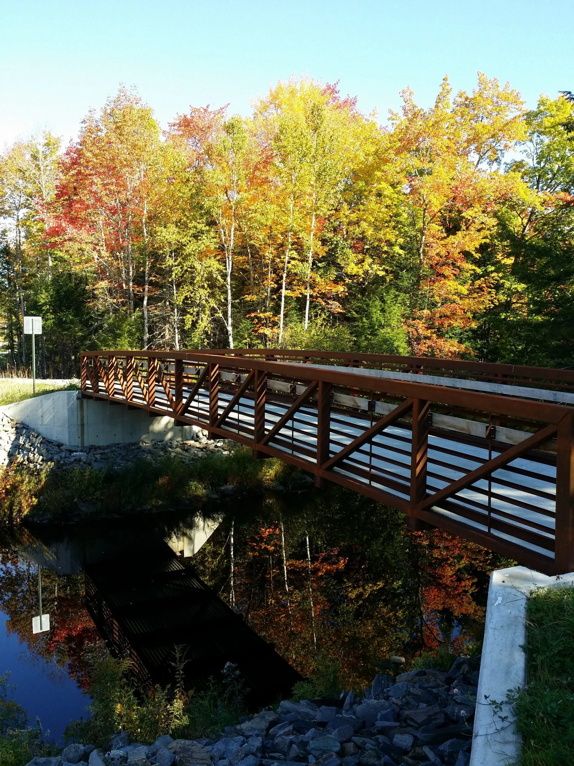
The Bikeway was developed in honor of Starr LaCoote, a young Passamaquoddy girl who was killed by a speeding logging truck. Other members of the community had also died in this same way. By creating this 1.3-mile paved stretch connecting residential areas and businesses with tribal government facilities and the town of Princeton, the Tribe sought to protect its own.
Built in 1985 from Land Claims Settlement funds and federal grants, the Bikeway was later rehabilitated in 2012. In recent years, Passamaquoddy Tribe at Motahkomikuk has been actively developing trails, such as the 3.8-mile shared-use Pit Trail, to enhance ease of transportation, recreation, and community connectivity. Looking ahead, the Tribe envisions expanding its trail network and adding sidewalks along Route 1 to improve pedestrian safety.
“The first law or Resolve authorizing the conveyance of Indian lands to non-Indians, which resulted in an actual transfer, is a Resolve of 1860 authorizing the conveyance of a mile strip off the eastern side of Indian Township to anyone ‘who shall build a good turnpike road across said Township along the valley of Tomah Stream…’ In 1862 the State Governor and council made the conveyance to William Todd of St. Stephen, New Brunswick.”
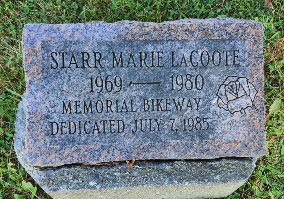
Starr Marie LaCoote
1969–1980
Memorial Bikeway dedicated July 7, 1985
Additional Resources
Donald Soctomah’s 2005 Report “Let Me Live as My Ancestors Had: Tribal Life and Times in Maine and New Brunswick, 1850–1890” contains excerpts from the Kalis land report and from many other important sources.
This research was compiled as part of the Mihqitahatom: The “I Remember” Walk at Motahkomikuk/Indian Township, which took place on August 17, 2025. For more research related to this area, click on the tags below. To download a hi-res version of the posters below for educational use, please contact where@atlanticblackbox.com.
This walk was a collaboration between the Passamaquoddy Tribe at Motahkomikuk (Indian Township), First Light, and the Walks for Historical & Ecological Recovery (WHERE), a series convened by Atlantic Black Box, following the actions and determination of the community and leadership from elders.
Poster design by Meadow Dibble