Who was Captain Tomah Lewey?
If the Bridge Was a Wall, This Passamaquoddy Leader Was a Bridge
Captain Tomah Lewey was known as an ambassador and a leader who bridged the gap between Tribal members and the wider community.
Around 1812, Tomah Lewey traveled up the St. Croix River with his wife and children and settled on a 10-acre island that became known as Lewy's Island after leaving their home in St. Andrews, New Brunswick due to an influx of Loyalists. The island became a tribal village known as Lewy's Island Settlement. Lewey himself became a prosperous farmer, managing hay fields. By some accounts he was, in his time, the richest man in Washington County.
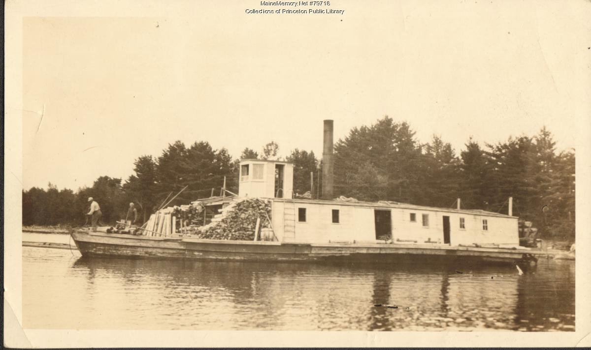
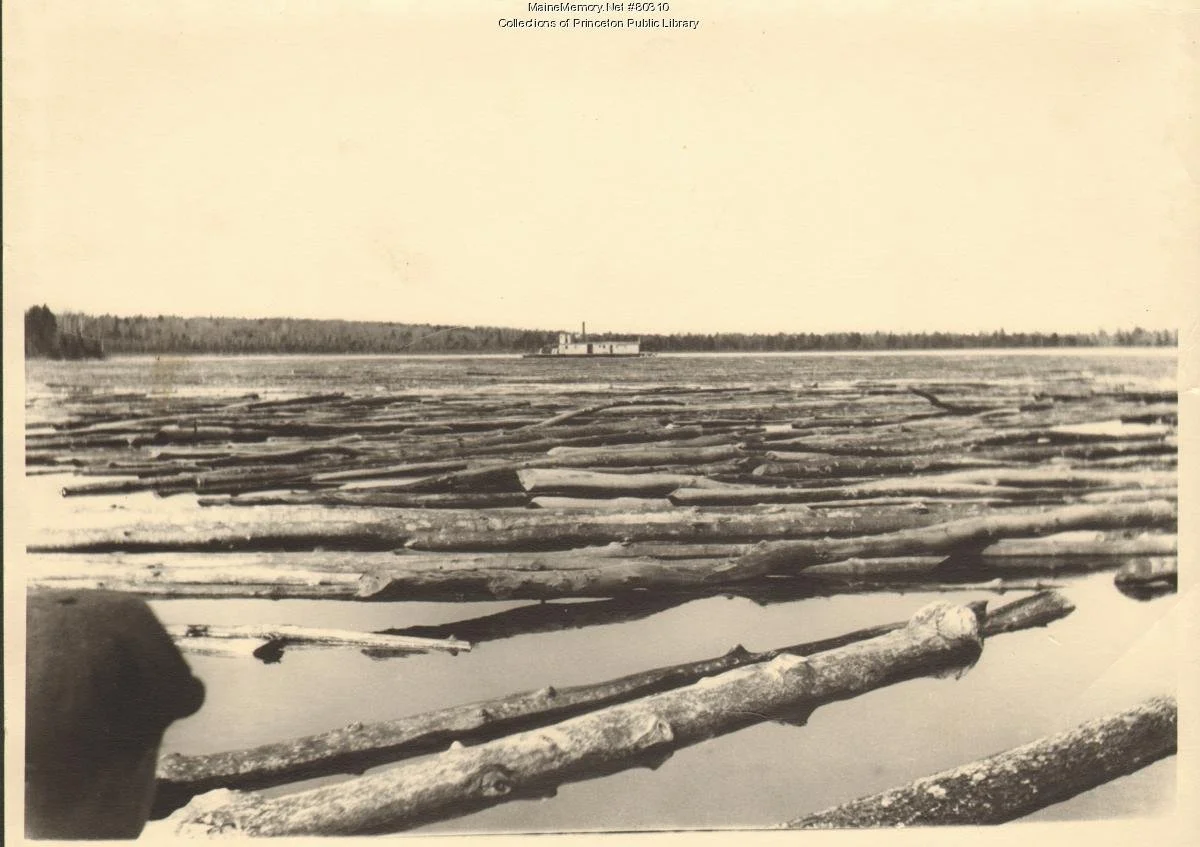
During the War of 1812, Lewey helped locate lost U.S. soldiers and surveyed the stagecoach route that is now Route 1. He earned the title "Captain" after being hired as a navigator on a steamboat, thanks to his knowledge of local waters. “Captain” is also a title worn by council members. The vessel, which was built in 1853 to haul logs, was later named the Captain Lewy in his honor. Around 1920, the steamboat was sunk in Greenland Cove on Long Lake, where its remains can still be seen today.
In 1851, the island dwellings were flooded by a "roll dam" built by a settler named Putnam Rolfe. This forced Lewey and his family to relocate to the north side of the river in the area now known as Motahkomikuk, or Indian Township. The original Captain Lewy Farm appears to have been roughly 220 acres in size.
After Captain Lewy died around 1868, the State of Maine sent three delegates to distribute his wealth among his children. These delegates took some of his land as payment. Lewey’s farm was later purchased by businesspeople from Princeton and was no longer owned by any Tribal members. In 1887, the Legislature gave the State Governor and Council the right to sell or lease the "whole or any part of the Indian Township."
With the exception of "The Strip," which remained occupied by Passamaquoddy, all but three lots on Indian Township were eventually leased (often for 999 years), granted or sold to non-Native people during the period 1871 to 1887.
Commemorating a Leader
In August 2008, a portion of Route 1 from the Princeton-Indian Township bridge to Topsfield was designated the Capt. Tomah Lewey Memorial Highway thanks to the efforts of Passamaquoddy Representative Donald Soctomah. This was the first major highway in Maine to be named after a Passamaquoddy person. At the dedication ceremony, former tribal Governor John Stevens, a descendant of Lewey's, and Chief Nicholas, cut a ribbon to officially open the memorial highway. Councilor Wayne Newell called Lewey an ambassador.
“Capt. Lewey was a leader. He understood the importance of communicating with his tribal members as well as the larger community,” Councilor Newell said.
Map of Indian Township 1906
This research was compiled as part of the Mihqitahatom: The “I Remember” Walk at Motahkomikuk/Indian Township, which took place on August 17, 2025. For more research related to this area, click on the tags below. To download a hi-res version of the posters below for educational use, please contact where@atlanticblackbox.com.
This walk was a collaboration between the Passamaquoddy Tribe at Motahkomikuk (Indian Township), First Light, and the Walks for Historical & Ecological Recovery (WHERE), a series convened by Atlantic Black Box, following the actions and determination of the community and leadership from elders.

Poster design by Meadow Dibble